2008 Border Circulation Analysis
Project status: Completed
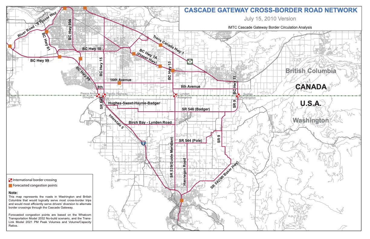
This analysis considered east-west routes that connect the four border crossings of the Cascade Gateway, and identified strategies for optimizing the Cascade Gateway transportation system.
Location
This study focused on the road network surrounding the four Cascade Gateway ports-of-entry. A map of the study’s cross-border road network is available for download.
Why this project was needed
The Cascade Gateway region is growing quickly. Regional travel, cross-border travel, and cross-border truck traffic result in frequent congestion of border crossings and the roads that serve them, especially given that the road network serving the region is much more of a north-south system than an east-west system. In recent years, real-time traveler information systems that allow travelers to compare wait times and select routes to avoid the longest wait times. Thus, this study set out to identify the most logical east-west routes and, if improvement is not required today, identify actions to preserve right-of-way for future demand.
Results
A primary road network for ongoing focus was developed based on the development of a cross-border model populated with passenger and freight vehicle intercept survey data, interviews with stakeholders showing their near and long-term improvement objectives, and a systems definition report which defined the geographic, temporal and modal scopes of the project.
Future efforts include modeling network changes referred to on the project map, as well as scenarios suggested by stakeholders, to develop a list of specific projects to improve east-west connectivity..
Project funding
The cost of the project was $200,000 (USD). Funding was provided by:
U.S. Federal Highway Administration
Transport Canada
B.C. Ministry of Transportation
Cities of Surrey, Abbotsford, and the District of Langley, BC
For more information
Contact Hugh Conroy, Director, Whatcom Council of Governments by email or phone (360-685-8382).