Scenic Byways
NSB Corridor Management Plans

What do Mt. Baker Highway and Chuckanut Drive mean to you? We want to know.
Please take the time to fill out a survey to help us better understand the community’s connection and priorities for the Mt. Baker Highway and Chuckanut Drive scenic byways.
The Whatcom Region’s Scenic Byways
Based on requirements set by the U.S. Federal Highway Administration’s (FHWA) National Scenic Byways (NSB) program, Washington State also recognizes and formally designates scenic byways – roadways, which because of their scenic, historic, recreational, cultural, archeological, and/or natural qualities – are destinations unto themselves.
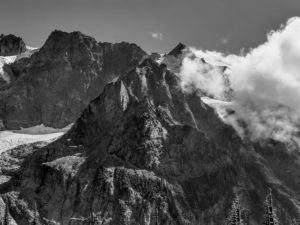
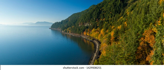
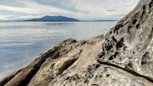
Whatcom County is home to two scenic byways, state route (SR) 542 (Mt. Baker Highway) and SR 11 (Chuckanut Drive). WCOG completed corridor management plans (CMPs) for SR 542 and SR 11 in 1997 and 2003 respectively.
- SR 11 (Chuckanut Drive) Corridor Management Plan 2003
- SR 542 (Mount Baker Highway) Corridor Management Plan 1997
WCOG is updating the SR 542 and SR 11 Corridor Management Plans
In 2023, WCOG, with support from Bellingham Whatcom County Tourism (BWCT), is updating the SR 542 and SR 11 CMPs.
It’s been over 20 years since the Whatcom region’s CMPs were completed. A lot has changed. Updating these plans will entail review and analysis of:
• Current traffic data (all modes as able)
• Status and possible additions to lists of the corridors’ intrinsic qualities
• Transportation infrastructure and operations changes
• Roadway safety and crash trends
• Implications for the corridors of pertinent local and tribal governments’ transportation and land use plans
Information gathered from the above will be used to update the plans’ strategies for:
• Maintaining and enhancing intrinsic qualities
• Supporting commerce and destination marketing
• Identifying needs for signage and interpretive resources
Stakeholder and Public Input Wanted!
In addition to input from the multiple governments and government agency stakeholders who own and manage these roadways and adjacent public lands, these plans need input from interested individuals, community-based organizations, user groups, and businesses.
• How can the existing plans be improved?
• What are the most prized features of the places linked by these corridors?
• What prized features need protection or enhancement?
• What changes in the last 20 years have been beneficial?
• What investments are needed to improve the experiences of our region’s residents, of visitors to these places, and of businesses?
• Are there barriers to accessing destinations along the corridor(s)?
• Are transportation and/or visitor services missing?
More Information and Ways to Give Input.
• Read one or both current CMPs (links above)
• Complete a short survey on what Mt. Baker Highway and Chuckanut Drive mean to you
• Within the survey, you may sign up for email alerts when draft CMP updates are available for review and for a related virtual open house.
• Call or email Hugh Conroy, Director of Planning at WCOG – hugh@wcog.org, 360 685-8384